Sunshine Coast grew rapidly from a string of beachside hamlets into a major urban corridor between Brisbane and the south-east Queensland hinterland. That expansion pushed development onto coastal dunes, alluvial flats, and the sloping margins of the Glass House Mountains. Each of those landforms behaves differently under load. Geotechnical instrumentation gives engineers the data they need to track how the ground actually responds once construction begins. Before installing instruments, field teams often run a MASW survey to map shear-wave velocity profiles across the site. That baseline helps position inclinometers and piezometers where they will capture the most useful readings.
One inclinometer reading per week during the first three months of excavation can prevent a slope failure that would cost ten times the monitoring budget.
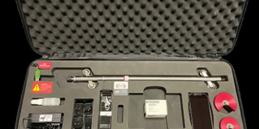
Scope of work
The city sits on a mix of Quaternary sands, Tertiary basalts, and metamorphic rocks from the D'Aguilar Block. More than 370,000 people now live across an area that stretches from Caloundra to Noosa. Many developments go up on reclaimed lowlands or former cane paddocks with high water tables. That makes geotechnical instrumentation essential for tracking pore pressure changes and lateral movement. A typical monitoring plan for a Sunshine Coast site includes inclinometers for slope stability, vibrating-wire piezometers for groundwater response, and settlement cells for fill settlements. Each instrument is specified to suit the local soil stiffness and expected strain levels. The design phase follows AS 1726 and AS 4678 for the installation methods and data logging intervals.
Technical reference image — Sunshine Coast
Area-specific notes
In Sunshine Coast, many sites sit close to tidal creeks or the Maroochy River. Groundwater fluctuates with the tide, and that cyclic loading can mask real pore pressure trends if piezometers are not vented and nested correctly. We often see instruments installed too shallow, missing the deeper aquifers that actually control settlement. Another common issue is placing inclinometer casings in fill zones without a stable socket into the underlying natural ground. The casing then moves with the fill, producing data that looks like deep-seated movement when it is only shallow creep. Proper design avoids those traps.
Supplied per instrument, traceable to NMI Australia
Linked services
01
Inclinometer systems
Manual and in-place inclinometers for slope and excavation monitoring. Casings installed in boreholes or embedded in fill. Data reduction per AS 4678.
02
Piezometer arrays
Vibrating-wire and pneumatic piezometers for groundwater monitoring. Single-tip and nested configurations. Vented to compensate for barometric pressure.
03
Settlement monitoring
Hydraulic settlement cells, plate gauges, and survey hubs for measuring vertical displacement during fill placement or foundation loading.
04
Strain and load cells
Strain gauges on piles and retaining walls, load cells on anchors and struts. Real-time data transmission via cellular or satellite loggers.
Standards used
AS 1726:2017 – Geotechnical site investigations, AS 4678:2002 – Earth-retaining structures (monitoring provisions), AS/NZS 1170.0:2002 – Structural design actions, general principles, ISO 17025:2017 – Laboratory and field instrument calibration
Frequently asked questions
How long does it take to install a geotechnical instrumentation system in Sunshine Coast?
A typical inclinometer and piezometer array for a residential subdivision can be installed in two to three days, including borehole drilling, casing assembly, and initial baseline readings. Larger projects with multiple arrays may take one to two weeks.
What is the typical cost range for geotechnical instrumentation design and installation?
The cost for a standard monitoring package covering inclinometers, piezometers, and settlement cells usually falls between AU$4,420 and AU$6,270. The final price depends on the number of instruments, borehole depth, and data logging requirements.
Which standards apply to geotechnical instrumentation in Australia?
AS 1726:2017 covers the site investigation and instrument installation. AS 4678:2002 provides the framework for monitoring earth-retaining structures. All instruments are factory-calibrated to ISO 17025 and supplied with traceable certificates.
How often should instruments be read during construction?
For active excavation or fill placement, weekly readings are standard. After construction stabilises, the interval can extend to monthly or quarterly. Real-time loggers can transmit data hourly if trigger thresholds are set.